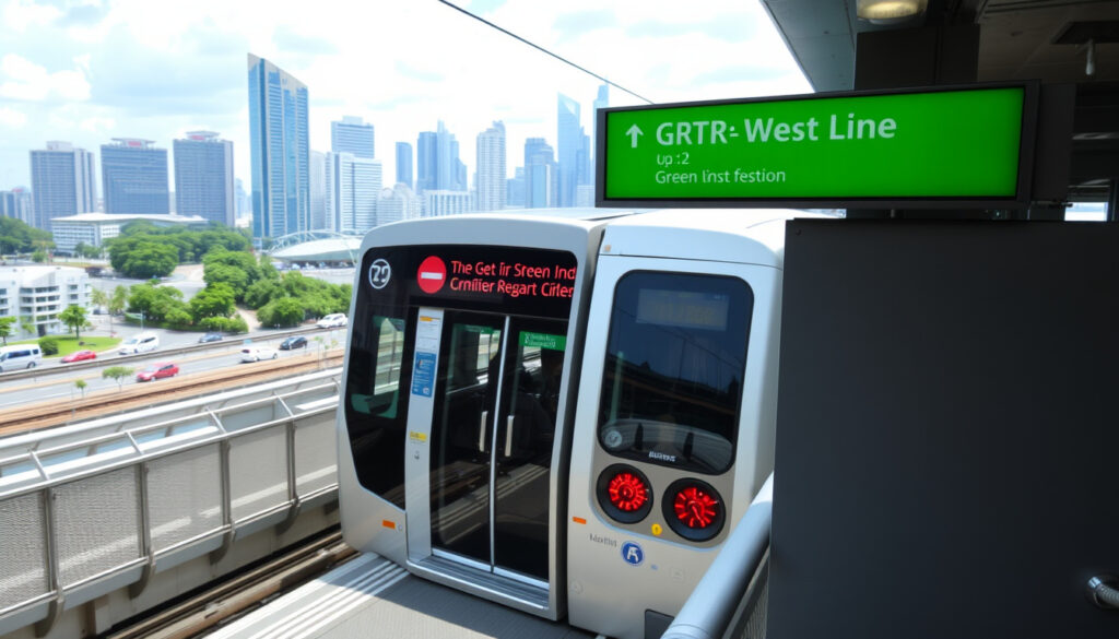
Green Line MRT Map: East-West Line Stations & Download
If you’ve ever stood at Raffles Place interchange wondering which direction the train was heading, you already know the green line is a backbone of daily travel. The East-West Line (EWL), coloured green on Singapore’s MRT map, runs about 57 km from Tuas Link in the west to Pasir Ris in the east, with a branch to Changi Airport. This guide traces how the green line MRT map has evolved since 1990, where you can download the official PDF, and what the 2026 network update means for passengers.
Line color on map: Green ·
Number of stations: 35 ·
Length: 57 km ·
Operator: SMRT Trains ·
Opened: 1990 (original section to Boon Lay) ·
Latest extension: 2017 (Tuas Link)
Quick snapshot
- EWL is Singapore’s green line on the MRT map (LTA, rail network page)
- Line runs Tuas Link to Pasir Ris, 57 km, 35 stations (LTA, rail network page)
- Operated by SMRT (Wikipedia, East–West Line article)
- Exact 2026 map layout may include minor changes for the green line, but specifics not yet confirmed by LTA.
- Future extensions beyond 2026 for the EWL remain unannounced.
- First section opened in 1990 from City Hall to Boon Lay (Wikipedia, East–West Line article)
- Changi Airport branch completed in 2008 (Land Transport Guru, EWL page)
- Tuas Link extension opened 2017 (LTA, rail network page)
- Changi Airport branch slated to be converted into Thomson-East Coast Line stations by mid-2030s (Land Transport Guru, EWL page)
- 2026 MRT map update expected to include new lines, but green line route remains unchanged. (Land Transport Guru, EWL page)
The table below summarises the key specifications of the East-West Line.
| Attribute | Value |
|---|---|
| First section opened | 1990 (Boon Lay) |
| Last extension | 2017 (Tuas Link) |
| Total stations | 35 |
| Length | 57 km |
| Color on map | Green |
| Operator | SMRT Trains |
What is the green line MRT map?
The green line MRT map is Singapore’s East-West Line (EWL), depicted as a green strip on the official rail network map. It connects the western industrial hub at Tuas Link to the eastern residential corridor ending at Pasir Ris, with a separate spur — the Changi Airport branch — serving travellers heading to the airport.
The East-West Line identity
The green line’s formal name, East-West Line, hints at its trans-island route. According to the Land Transport Authority (LTA), Singapore’s government rail agency, the line runs about 57 km and serves 35 stations (LTA, rail network page). The first segment opened in 1990 from City Hall to Boon Lay, and the line has since been extended westward to Joo Koon (2009) and Tuas Link (2017).
Importance of the green line in Singapore’s rail network
By length, the EWL is the longest MRT line in operation. It links several regional centres — Jurong East in the west, Tampines in the east, and the central business district via City Hall and Raffles Place — making it a critical commuter artery. Interchanges at Jurong East, Buona Vista, City Hall, Raffles Place, Paya Lebar, and Outram Park connect passengers to the North-South Line, Circle Line, North East Line, and Downtown Line. Land Transport Guru, a specialist transit site, notes that the line is operated by SMRT Trains.
For the daily commuter in Jurong or Tampines, the EWL is often the only direct rail link to the city centre. Any disruption or extension directly shapes travel time for roughly one-third of Singapore’s MRT ridership.
The green line’s role as a central corridor means its map is more than a route diagram — it defines how millions plan their daily journeys.
Which stations are on the green line MRT?
Eighteen station pairs, one pattern: the green line’s 35 stations follow a dual-corridor structure — a main east-west spine plus a short airport branch.
Full station list from west to east
Below is the complete list of stations from west to east.
| Station code | Station name | Interchange(s) |
|---|---|---|
| EW33 | Tuas Link | — |
| EW32 | Tuas West Road | — |
| EW31 | Tuas Crescent | — |
| EW30 | Gul Circle | — |
| EW29 | Joo Koon | — |
| EW28 | Pioneer | — |
| EW27 | Boon Lay | — |
| EW26 | Lakeside | — |
| EW25 | Chinese Garden | — |
| EW24 | Jurong East | North-South Line (NSL) |
| EW23 | Clementi | — |
| EW22 | Dover | — |
| EW21 | Buona Vista | Circle Line (CCL) |
| EW20 | Commonwealth | — |
| EW19 | Queenstown | — |
| EW18 | Redhill | — |
| EW17 | Tiong Bahru | — |
| EW16 | Outram Park | North East Line (NEL), Thomson-East Coast Line (TEL) |
| EW15 | Tanjong Pagar | — |
| EW14 | Raffles Place | North-South Line (NSL) |
| EW13 | City Hall | North-South Line (NSL) |
| EW12 | Bugis | Downtown Line (DTL) |
| EW11 | Lavender | — |
| EW10 | Kallang | — |
| EW9 | Aljunied | — |
| EW8 | Paya Lebar | Circle Line (CCL) |
| EW7 | Eunos | — |
| EW6 | Kembangan | — |
| EW5 | Bedok | — |
| EW4 | Tanah Merah | — (branch to Changi Airport) |
| EW3 | Simei | — |
| EW2 | Tampines | Downtown Line (DTL) |
| EW1 | Pasir Ris | — |
Changi Airport branch (CG)
At Tanah Merah (EW4), a shuttle branch diverges south-east to serve Expo (CG1) and Changi Airport (CG2). The branch opened in 2001 to Expo and extended to the airport terminal in 2008. Land Transport Guru, a Singapore transit reference site, reports that this branch is slated to be transferred to the Thomson-East Coast Line by the mid-2030s, a change that will reshape the green line’s map.
Where can I download the green line MRT map PDF?
Two official sources, one consistent result: the green line MRT map is available as a PDF download from LTA and SMRT.
Official LTA download page
The Land Transport Authority (Singapore’s government transport regulator) hosts the official rail network map as a downloadable PDF on its East-West Line page (LTA, rail network page). The PDF includes the full system — not just the green line but all six MRT lines plus the LRT — making it useful for understanding how the EWL fits the broader map.
Third-party map sources
For a dedicated green line view, SMRT Journeys (the operator’s official trip-planning site) provides an interactive map with station-by-station information. Commuters can also use the Moovit app, which lists 33 directional stops between Tuas Link and Pasir Ris (a count that excludes one or two branch-specific configurations).
How to use the PDF for offline navigation
Once downloaded, the PDF works on mobile devices without internet, showing station codes (EW prefix), interchange markers, and fare zone boundaries. The map is updated each year; the current version — valid through 2025 — includes the 35-station green line as a continuous strip with the Changi Airport branch shown as a separate spur.
Whether you choose the official PDF or an interactive map, having the right version ensures accurate navigation.
How does the green line connect to other MRT lines?
Six stations, six handshake points: the EWL links to every other MRT line in Singapore except the Thomson-East Coast Line (which will change after the Changi Airport branch transfer).
Interchange stations list
- Jurong East (EW24/NS1): Connects to the North-South Line. LTA identifies this as one of the busiest rail interchanges in Singapore.
- Buona Vista (EW21/CC22): Connects to the Circle Line.
- City Hall (EW13/NS25): Connects to the North-South Line.
- Raffles Place (EW14/NS26): Connects to the North-South Line.
- Paya Lebar (EW8/CC9): Connects to the Circle Line.
- Outram Park (EW16/NE3/TE17): Connects to the North East Line and Thomson-East Coast Line.
Additional interchanges include Tampines (EW2/DT32) linking to the Downtown Line and Bugis (EW12/DT14), also on the Downtown Line. Land Transport Guru’s station database confirms these connections (Land Transport Guru, EWL page).
Connecting to the Circle Line, North-South Line, etc.
The Circle Line meets the EWL at Buona Vista and Paya Lebar, offering a continuous loop alternative through the city fringe. The North-South Line intersects at Jurong East, City Hall, and Raffles Place — making City Hall the MRT’s most central two-line hub. A traveller from Jurong East to, say, Orchard can take the green line to City Hall and switch to the North-South Line without leaving the paid area.
What this means: the EWL’s six interchange stations are the linchpins of Singapore’s rail integration. For a commuter in Pasir Ris boarding the green line, the maximum transfer distance to any other line is two interchanges.
What is the future of the green line MRT map in 2026?
One extension confirmed, one conversion pending: the 2026 map will add new lines outside the green corridor, but the EWL itself is due for only minor route adjustments.
Planned extensions and new stations
No major green line extensions have been announced by LTA for 2026. The upcoming MRT map update will primarily feature the opening of new Thomson-East Coast Line stations, which will add connectivity at Outram Park (already an interchange) and eventually absorb the Changi Airport branch. Land Transport Guru’s analysis indicates this branch conversion is likely to occur by the mid-2030s, not 2026 (Land Transport Guru, EWL page).
Impact on current map layout
For 2026, the green line route remains unchanged: Pasir Ris to Tuas Link, with the Changi Airport branch intact. The map’s appearance will shift only insofar as new Thomson-East Coast Line stations appear alongside the green corridor in the downtown area. The EWL’s colour, station codes, and 35-station count will stay consistent.
The green line’s stability is a double-edged sword: commuters get consistency, but the lack of new green-line stations means the line will not serve upcoming developments in the north-east or Jurong Lake District directly. Riders relying on the Changi Airport branch face a mid-2030s switch to the Thomson-East Coast Line, which may mean a longer walk to the same terminal.
The stability of the green line provides predictability, but the upcoming changes to the Changi Airport branch signal a longer-term shift in the network’s layout.
Timeline: How the green line MRT map evolved
Five milestones, five expansions: from a single central segment to a 57 km spine.
Below is the timeline of key expansions.
| Date | Event |
|---|---|
| 1990 | Original section opens from City Hall to Boon Lay (now part of East-West Line). [Wikipedia] |
| 2001 | Extension to Expo (CG1) opens. [Land Transport Guru] |
| 2008 | Changi Airport station (CG2) opens, completing the branch. [Land Transport Guru] |
| 2017 | Tuas Link extension (EW33) opens, extending the line from Joo Koon westward. [LTA] |
| 2026 (expected) | Updated MRT map includes new lines; green line unchanged. |
The pattern: each extension — Boon Lay in 1990, Expo in 2001, Changi Airport in 2008, Tuas Link in 2017 — has added approximately one new corridor every nine years. If that cadence holds, the next green-line extension after the mid-2030s branch conversion could arrive around 2040, though no official plan has been published.
Clarity: What is confirmed vs. unclear on the green line
Confirmed facts
- Green line is the East-West Line, coloured green on the MRT map (LTA, official rail network page).
- 35 stations as of 2024 (LTA, East-West Line page).
- Official map available from LTA as PDF download.
- Six interchange stations connect to other lines (Land Transport Guru, EWL page).
What’s unclear
- Exact 2026 map layout — may include minor visual changes for the green line, but LTA has not released specifics.
- Future extensions beyond 2026 for the green line remain unannounced by LTA.
Understanding which facts are solid and which are still in flux helps commuters make informed decisions about their routes.
Quotes from the experts
“Jurong East is one of the busiest rail interchanges in Singapore, serving both the East-West Line and North-South Line.”
— LTA, official rail network page
“The Changi Airport branch is being converted into Thomson-East Coast Line stations by the mid-2030s, which will remove the green line’s airport spur.”
— Land Transport Guru, EWL analysis
“SMRT operates the East-West Line, which is the longest MRT line in Singapore at 57 km.”
— Wikipedia, East-West Line article
The green line MRT map is a fixed reference point in Singapore’s evolving rail network, but its constancy masks a quiet transformation: the Changi Airport branch’s eventual departure and the absence of new green-line stations mean riders must look to other lines for future connectivity. For the commuter in Pasir Ris, the choice is clear: rely on the green line for the next decade as a stable spine, or plan for a mid-2030s switch at Tanah Merah if airport access is critical.
Related reading: ESR BizPark @ Chai Chee: MRT, Parking, Halal Food Guide · ETS JB to KL: Fares, Schedules & 2026 Guide
mrtmapsingapore.com, moovitapp.com, sgtrainstatus.com, journey.smrt.com.sg, scribd.com, lta.gov.sg, visitsingapore.com, singaporemrtmaps.com, channelnewsasia.com
For a broader view of upcoming changes, check out the 2026 MRT map update which includes new stations and line extensions.
Frequently asked questions
What is the first station on the green line?
If travelling west to east, the first station is Tuas Link (EW33). If travelling east to west, the first station is Pasir Ris (EW1).
What is the last station on the green line?
From the western end, the last station is Pasir Ris (EW1). From the eastern end, the last station is Tuas Link (EW33).
Is the green line MRT free?
No, the East-West Line requires a valid fare card or ticket. Fares are distance-based and managed by the Land Transport Authority.
How long does it take to travel from Pasir Ris to Tuas Link?
The full journey from Pasir Ris to Tuas Link on the green line takes approximately 65 minutes, covering all 35 stations.
Can I use the same MRT ticket on the green line?
Yes, Singapore’s unified fare system accepts EZ-Link, NETS FlashPay, contactless bank cards, and single-trip tickets on all MRT lines, including the East-West Line.
Are there any night services on the green line?
Yes, SMRT operates Night Rider bus services that complement the last train timings. The MRT itself runs from about 5:30 AM to midnight daily.
Does the green line MRT have wheelchair access?
Yes, all East-West Line stations are wheelchair-accessible, with barrier-free routes, lifts, and tactile guidance systems installed across the line.
More related posts
 JJ Lin Heart Condition: Signs, Reversal, and What to Know
 Jurassic World Rebirth Box Office: Confirmed Hit with $869M
 Uni$ to Miles: How to Convert UOB Rewards to KrisFlyer & Asia Miles
 Choa Chu Kang Columbarium Guide: Booking, Costs & Rules
 Olive Vine Pasta Fusion: Menu, Reviews & Owner (Marina Square)
 Lecturer Jobs in Singapore: Salary, Requirements & Demand
 Sakura Gardens by the Bay 2026: Cherry Blossom Season Guide
 100 Pounds in KG – Exact Conversion to 45.359 kg
